Trail Walking Val d'Oingt - 69620-StLo-160412-Azergues+Genetière+Berthier - Photo

69620-StLo-160412-Azergues+Genetière+Berthier

 adye
adye

User

© OpenStreetMap contributors
Length
Length
5.2 km
Max alt
Max alt
388 m
Uphill gradient
Uphill gradient
146 m
Km-Effort
Km-Effort  
7.1 km
Min alt
Min alt
260 m
Downhill gradient
Downhill gradient
146 m
Boucle
Boucle
Yes
Creation date :
2016-04-15 00:00:00.0
Updated on :
2016-04-15 00:00:00.0

(2 Reviews)

Walking
Walking
1h38
Difficulty : Easy

Scan this QR Code to open this trail in the SityTrail application

FREE GPS app for hiking

Logo SityTrail SityTrail

IGN / Geographical institutes

Download SityTrail from the App Store Download SityTrail from Google Play

Logo SityTrail SityTrail Plus

The world is yours!

Download SityTrail from the App Store Download SityTrail from Google Play Download SityTrail on Huawei AppGallery

About

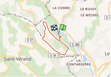
Trail Walking of 5.2 km to be discovered at Auvergne-Rhône-Alpes, Rhône, Val d'Oingt. This trail is proposed by adye.

Description

Départ de la balade au bord de de la rivière l'Azergues. Table de pique-nique (sans banc) et plage en galets pour les pieds non frileux! Hameaux traversés : La Genètière, Le Berthier. Vue panoramique sur Saint-Laurent d'Oingt, Oingt et Le Bois d'Oingt.

Elevation profile

Positioning

Country:
France
Region :
Auvergne-Rhône-Alpes
Department/Province :
Rhône
Municipality :
Val d'Oingt
Location:
Saint-Laurent-d'Oingt
Start:(UTM)
620236 ; 5087289 (31T) N.

Comments

Please log in to post a review or rate the element


Close
My subscriptions